The CERCLA, commonly known as Superfund, was enacted by Congress on December 11, 1980. This law created a tax on the chemical and petroleum industries and provided broad Federal authority to respond directly to releases or threatened releases of hazardous substances that may endanger public health or the environment. CERCLA established prohibitions and requirements concerning closed and abandoned hazardous waste sites, provided for liability of persons responsible for releases of hazardous waste at these sites, and established a trust fund to provide for cleanup when no responsible party could be identified. dse has conducted several projects under CERCLA, including the following projects:
Pre-closure CERCLA Site Condition Verification
U.S. EPA OFFICE OF INSPECTOR GENERAL
PENNSYLVANIA, MISSOURI, LOUISIANA, NEW YORK, WISCONSIN
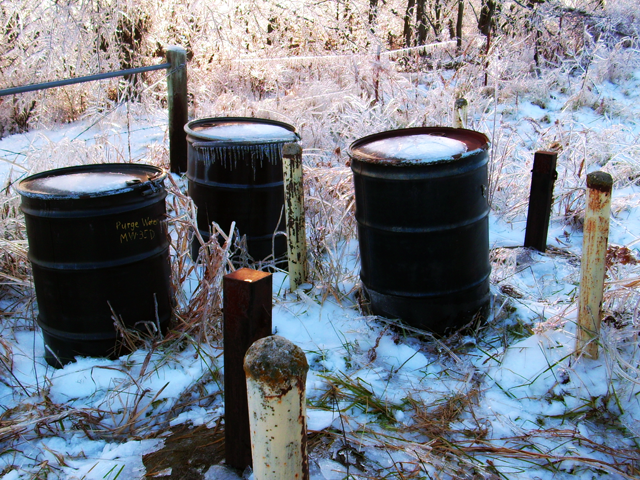
sampling of nine CERCLA Superfund sites. Sampling and laboratory analyses of soils, groundwater and surface water are being performed to verify that the current conditions meet the required cleanup goals for the site. These efforts are highly sensitive as the results determine whether or not the site is eligible for removal from the National Priority List. Chemicals of concern at these sites include metals, hydrocarbons, volatile organic compounds, semi-volatile organic compounds, hydrocarbons, pesticides and herbicides. Sites range in size from single households to over 100 acres. For each site, dse mobilizes a field team to obtain samples, followed by preparation of two major reports.
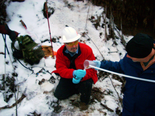
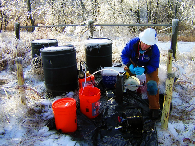
The reports support EPA decision-making and subsequent reporting to Congress. One report is due 10 days after completing the initial sampling events, and a final report 35 days after receipt of extensive laboratory analyses packages. These reports have typically exceeded 3,000 pages, and must be technically accurate, concise and with clear identification of deviations from past data protocols.
Waterloo Refinery Assessment
U.S. EPA SUPERFUND TECHNICAL ASSESSMENT AND RESPONSE TEAM (START) REGION 6
WATERLOO, ARKANSAS
dse assessed the environmental impacts of an abandoned oil refinery located in a remote area of Arkansas. The assessment was targeted at identifying wastes and chemicals of concern that would pose a threat to local residents and remediation workers. Asbestos was a major concern because of the large quantity of damaged suspected ACBMs believed to be present on-site. Pipe insulation was observed scattered across the site and concentrated in several large piles which appeared to have been in place for many years. dse collected water and sludge samples from waste pits and visually inspected the approximate 80 acre facility. dse designed a sampling strategy that limited the number of asbestos samples collected to control costs and complete the inspection under an accelerated schedule.
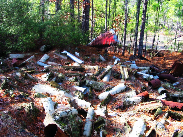
dse prepared a report including drafted site plans identifying sample locations, site photographs, summary tables and conclusions/recommendations. In addition, air samples were collected in strategic locations to establish baselines for negative exposure assessments. Three different types of asbestos were identified in 11 different materials with an estimated total volume of more than 1,500 cubic yards. dse personnel prepared an abatement specification and performed a walk through with qualifying abatement firms.
Remedial Investigation and Feasibility Study Support (RI/FS)
NATIONAL OCEANIC ATMOSPHERIC ADMINISTRATION (NOAA)
PRIBILOF ISLANDS, ALASKA
NOAA contracted CESI/dse to assess environmental impacts from prior activities to various sites on St. Paul Island. These sites had been impacted by various activities on the island since it came under the aegis of the United States of America. Many of these sites were impacted by diesel fuels, other petroleum hydrocarbons, and metals. The assessment activities were accomplished in support of planned remedial activities, which were intended to return the island to near pristine condition prior to returning the sites to the indigenous population. dse personnel installed and logged over 60 soil borings that were advanced and converted into monitoring wells.
The monitoring wells were used to collect groundwater characterization data, and to determine the hydrogeologic properties of the aquifer on the island. The water samples and soil cuttings were analyzed to determine the extent of impacts to the groundwater or vadose zone. dse personnel removed three underground storage tanks, and participated in the geological mapping of parts of the island. Phase I building condition surveys were also conducted by a dse field crew for several buildings that were used and/or operated by NOAA or other Federal Government agencies.